GPS PhotoMapper NG2
GPS PhotoMapper NG2 creates clear and detailed reports with just a few clicks
Program info
GPS PhotoMapper NG2 is a software that allows users to create detailed PDF reports with a few clicks of the mouse. It allows users to integrate GPS tracks with GIS, manage pictures with the ThumbnailViewer, and add pictures to a project via drag and drop.
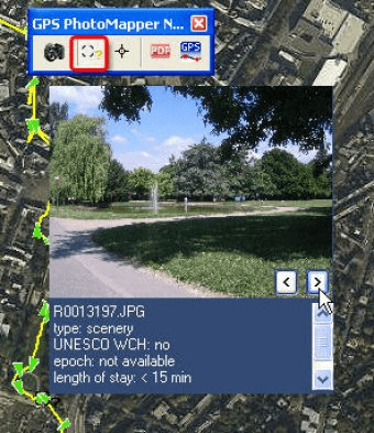
With GPS PhotoMapper NG2 you can create clear anddetailed pdf reports with just a few mouse clicks. Select the pictures and attributes to be exported and integrate a map in which the picture is localized.
You have recorded a log file while making the pictures? With GPS PhotoMapper NG2 you can easily integrate your gps tracks within the GIS. You always know where you've been.
In GPS PhotoMapper NG the picture managment is dynamically controlled by means of the ThumbnailViewer. Pictures can easily be added to a project via drag & drop. Just select the pictures in your data browser and drag them into GPS Photomapper's ThumbnailViewer. By deleting a picture in ThumbnailViewer the complete dataset will be removed.
Details
Extensions

No information available
The data will be available later.Awards

There are no awards
Over time, app awards will appear here.